
Vision
4.69 Durham City’s natural green spaces and networks of greenery will be protected and enhanced for the leisure, health, economic and environmental benefits they provide for residents, visitors and people working in the City.
Objectives
4.70 The objectives of this theme are:
- To protect and enhance the green infrastructure in Our Neighbourhood;
- To protect and enhance the green assets of the World Heritage Site, and its inner setting, and of the character areas of the Durham City Conservation Area;
- To address deficiencies of green infrastructure within Our Neighbourhood.
Context
Definition of green assets
4.71 Green infrastructure is the network of green assets (multi-functional green spaces and natural resources) within the City (PPG ‘Natural environment’ Glossary). Green assets cover a range of spatial scales and types of use. They include:
- the River and riverbanks, streams, ponds (i.e. blue infrastructure);
- open spaces (see Table 1 below);
- wildlife sites and wildlife habitats;
- woodland;
- parks and botanic gardens;
- public, community and private gardens;
- green landscaped areas;
- the grounds of the University, colleges, schools, hospitals, businesses and business parks;
- highway verges and railway embankments;
- footpaths and cycle paths;
- green corridors (a narrow strip of land containing enough habitat to support wildlife and connecting wildlife populations and habitats separated by human activities or structures (such as buildings or roads). They include riverbanks, cycle paths and footpaths, road verges);
- dark corridors (unlit strips of land (e.g. footpaths, verges and riverbanks) that provide wildlife with protection from artificial lighting and routeways between larger, unlit areas of habitat);
- cemeteries and churchyards;
- allotments and community gardens;
- sports and playing fields;
- amenity green spaces;
- designated Local Green Spaces;
- the Green Belt;
- trees, hedgerows, grass, vegetation;
- built structures such as green roofs, green walls, natural or artificial water features, bird and bat boxes and roosting sites.
4.72 The above list includes open spaces. An open space is defined as any open piece of land that is undeveloped (i.e. has no buildings or other built structures on it): it can be both public or private (with or without public access allowed). Open spaces can be green or hard, or a bit of both. A typology of open spaces (Department for Communities and Local Government, no date, Annexe) is given in Table 1 below:
Table 1: Topology of open spaces
|
Green Open Spaces |
Mixed Spaces (including both green and hard areas) |
Hard Open Spaces |
|
Natural / semi- natural spaces (such as wildlife sites, woodland) |
Civic spaces with soft landscaping (e.g. grass, trees, flowerbeds, water features) |
Civic spaces (hard) (such as town squares, public seating areas) |
|
Green corridors (including riverbanks, cycle paths and footpaths, road verges) |
|
Play spaces (for children and young people |
|
Waterways (including rivers, streams) |
Outdoor sports facilities (with grass surfaces) |
Outdoor sports facilities (including playing fields, open air courts) (with hard surfaces) |
|
Parks and gardens |
Roundabouts (with soft landscaping) |
Roundabouts (with hard surfaces) |
|
Churchyards, cemeteries and burial grounds (open or closed to burials) |
Amenity green spaces (most commonly, but not exclusively in housing areas – including informal recreation spaces, green spaces in and around housing, domestic gardens and village greens) |
|
|
Allotments and community gardens |
Road verges |
|
|
|
Vacant lot (with vegetation) |
Vacant lot (with hard surfaces) |
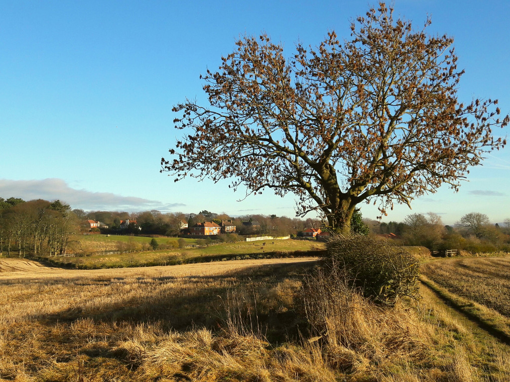
4.73 The City’s attractiveness and character is enhanced by the natural open spaces and networks of greenery which are valued throughout the year by residents, visitors and those working in the City. This green infrastructure serves a variety of purposes: the character setting of the World Heritage Site and conservation areas, attractive open spaces and footpaths for recreation and connections between communities, beneficial effects on people’s health, an attractive setting which encourages new businesses and new residents to move to the City, visitor and tourist attractions, beneficial habitats for biodiversity and mitigating the effects of climate change. (PPG ‘Natural environment’ para. 006)
4.74 Table D1 in Appendix D lists landscape and natural environment assets and open spaces in Our Neighbourhood, describing the context as known at the time of compiling the data (September 2019). This identifies many resources, however it cannot be used as a comprehensive list.
Justification
4.75 This justification refers to the Green Infrastructure theme as a whole. Additional, specific justification for an individual policy is given with the policy itself.
4.76 The Forum’s priority survey (Durham City Neighbourhood Planning Forum, 2015) identified that local people valued highly the green infrastructure of the City. One of the highest rated aspects was the riverbank setting and riverside walks. In addition they rated the woodland ‘wedges’ which bring green space into City, pedestrianised areas, Council flower displays and tree plantings, parks and nature areas. One of their priorities is to protect green spaces/green belt and the environment. In the Forum’s study of the views of young people (Durham City Neighbourhood Planning Forum, 2016a), one of their priorities included the River Wear. The young people all enjoyed the river and the river walks, and felt that even more could be made of the riverbanks to improve access and leisure opportunities.
4.77 An environmental objective is one of the three objectives in achieving sustainable development (NPPF para. 8). The NPPF covers green infrastructure in a number of chapters:
- Chapter 15. Conserving and enhancing the natural environment. “Planning policies and decisions should contribute to and enhance the natural and local environment by: a) protecting and enhancing valued landscapes, sites of biodiversity or geological value and soils (in a manner commensurate with their statutory status or identified quality in the development plan); … d) minimising impacts on and providing net gains for biodiversity, including by establishing coherent ecological networks that are more resilient to current and future pressures” (NPPF para. 170);
- Chapter 8. Promoting healthy and safe communities, e.g. “through the use of … high quality public space … [and] the provision of safe and accessible green infrastructure, sports facilities … allotments and layouts that encourage walking and cycling” (NPPF para. 91)
- Chapter 13. Protecting Green Belt land
- Chapter 14. Meeting the challenge of climate change, flooding and coastal change, e.g. managing risks “through suitable adaptation measures, including through the planning of green infrastructure” (NPPF para. 150)
4.78 ‘The Natural Choice’ (the natural environment white paper: UK Government, 2011) emphasises that a healthy, properly functioning natural environment is the foundation of sustained economic growth, prospering communities and personal well-being. The biodiversity strategy (Department for Environment, Food and Rural Affairs, 2011) builds on the natural environment white paper. Its mission is to halt overall biodiversity loss, support healthy well-functioning ecosystems and establish coherent ecological networks, with more and better places for nature for the benefit of wildlife and people.
4.79 The Natural Capital Committee (2018) was set up to provide the UK Government with independent advice on protecting and improving natural capital, i.e. green assets, land, minerals and water It is currently working on developing a 25 year Environment Plan to implement the ‘Natural choice’ White Paper (UK Government, 2011). The goals they recommend include providing everyone with access to local green space, restoring and enhancing wild species populations and habitats, and managing developments so that there is an overall net increase in natural habitat.
4.80 The ‘Green Infrastructure Guidance’ (Natural England, 2009) provides a comprehensive overview of the concept of green infrastructure, signposts to other relevant information, and maps out wider policy priorities and drivers for green infrastructure. Its aim is to drive forward green infrastructure planning and delivery.
4.81 More than 70 organisations from across multiple sectors have joined forces to create a ‘Charter for Trees, Woods and People’ with the aim of guiding UK policy and practice. It sets out ten principles “for a society in which people and trees can stand stronger together”.

4.82 Durham County Council (2018b) has produced a ‘Durham Strategic Green Infrastructure Framework’. One of their delivery priorities is: “Enabling local communities to engage in the enhancement and creation of GI in their area within their Neighbourhood Plans”. The strategic principles include:
- “Ensure that there is a functional and well-connected strategic green infrastructure across the County. Gaps or missing links should be addressed;
- Maximise opportunities to improve both strategic GI and more local GI whenever change is being considered …”
4.83 The framework provides basic design principles to help achieve GI benefits, e.g.
- “Recognise, protect and manage Durham’s natural green (and blue) infrastructure assets …”
- “Ensure decisions affecting land result in a net gain for biodiversity”
- “Expand, enhance and link Durham’s wildlife habitats where opportunities arise”
- “Enhance the structure of the landscape through protecting and regenerating primary hedgerow boundaries”
- “Support communities in the identification of locally valued green spaces in their area for potential designation as Local Green Space, and inclusion in Neighbourhood Plans where appropriate”
- “Ensure that adequate space is allocated for allotments (where there is a deficit) and protect existing allotment gardens/city farms”
- “Ensure that green links/corridors are maintained or created through housing developments, linking to the surrounding landscape”
- “Protect and create (where appropriate) public rights of way and other sustainable transport routes to encourage people to utilise more sustainable travel modes”
- “Incorporate green roofs and living walls into new developments”
- “Ensure that adequate GI, of a suitable quality, is incorporated into the ‘Masterplanning’ of settlements/new housing estates/new industrial estates etc.”
4.84 The Sustainable Communities Strategy for County Durham 2014-2030 (County Durham Partnership, 2014) has a section ‘Altogether greener’ with the aim of maximising the value and benefits of Durham’s natural environment. The Countryside and Rights of Way Act 2000 placed an obligation on local authorities to produce and maintain a Rights of Way Improvement Plan (ROWIP). The Rights of Way Improvement Plan for County Durham 2015–2018 (Durham County Council, 2015d) The ‘opportunities’ (essentially the policies) identified in the plan include an aim that paths are provided and improved as part of developments, and that gateway sites to public green spaces are improved.
4.85 Durham City falls within The Wear Lowlands character area of the County Durham Landscape Character Assessment and Landscape Strategy (Durham County Council, 2008a,b). The strategy for the Wear Lowlands is: “To conserve the character of the valley landscapes of the Wear while enhancing those areas which have been most affected by development” (Durham County Council, 2008b, p.104). These documents contain detailed contextual information and numerous objectives. Baseline information on biodiversity and geodiversity is available in the Council’s Technical Paper No. 12 (Durham County Council, 2009).
4.86 A number of the saved policies from the City of Durham Local Plan cover green assets (E1,2,2A,5,5a,10,14 to 20,25,26; R1 to 3,5,11 to 13; T21; Q5,6).
4.87 The Durham City Regeneration Masterplan (Durham County Council, 2014) and its update (Durham County Council, 2016c) has a number of implementation projects and actions relevant to the green infrastructure of Our Neighbourhood (a subset of the Durham City area covered by the Masterplan), i.e. ‘Keeping Durham Green’ by e.g. care of the River Wear banks, adding to existing green spaces.
4.88 Local strategies and initiatives emphasise the importance of the green infrastructure within the City, in particular the Durham City Conservation Area Appraisal (Durham County Council, 2016b) and the Durham Castle and Cathedral World Heritage Site Management Plan (Durham World Heritage Site, 2017). The Durham City Conservation Area comprises “the pre-1900 expansion of the city and the majority of the natural ‘bowl’ (the upper slopes of which present a largely rural backdrop to views of the Cathedral), the important green wedges of open countryside and other significant green areas which contribute to and enhance the setting of the historic buildings and the city as a whole” (Durham County Council, 2016b, Executive Summary, p.2). Management proposals for each character area are available, which include management, conservation and enhancement of green assets. Most of Our Neighbourhood falls within the area covered by the World Heritage Site and by its inner setting (see Maps 1 and 2). The immediate context of the river and the tree lined river banks is a key component of the World Heritage Site’s Outstanding Universal Value. The inner setting of the World Heritage Site, and protection of views to and from the World Heritage Site, is another key component.
4.89 Durham County Council (on behalf of a Steering Group of the main landowners of 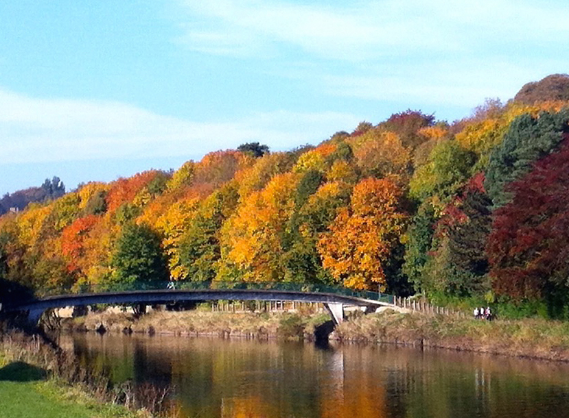 the Durham riverbanks) commissioned Blue Sail Consulting Ltd (2017) to produce a development and management strategy for the Durham riverbanks, focussing on the Peninsula riverbanks. It recommends a number of projects to revitalise this area. These riverbanks projects intersect with the Emerald Network policy G3. (See also relevant initiatives in the companion document ‘Looking Forwards: Durham as a Creative and Sustainable City’).
Planning Policies and Proposals for Land Use
4.90 The policies related to this theme are:
- Policy G1: Protecting and Enhancing Green and Blue Infrastructure
- Policy G2: Designation of Local Green Spaces
- Policy G3: Creation of the Emerald Network
- Policy G4: Enhancing the Beneficial Use of the Green Belt
Next section: Policy G1: Protecting and Enhancing Green and Blue Infrastructure